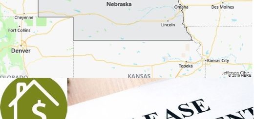
Interstate 80 or I -80 is an Interstate Highway in the U.S. state of Pennsylvania. The highway forms an east-west route through the northern half of the state, from the Ohio border at Sharon to the New Jersey border at Stroudsburg. It is striking that despite its considerable length, I-80 does not provide access to larger places in Pennsylvania. I-80 is 501 kilometers long in Pennsylvania.
Topschoolsoflaw: State overview and brief history of Pennsylvania, including its geography and popular cities.
Travel directions
I-80 west of Bellefonte.
The highest point on I-80 at Penfield, at 686 meters.
At Sharon, Interstate 80 in Ohio enters the state of Pennsylvania from Cleveland. Shortly after the state line, there is an interchange with Interstate 376, which leads south to Pittsburgh. I-80 has 2×2 lanes and heads east through a flat area with an alternation of forest and meadows. Near Grove City, Interstate 79 joins cloverleaf, then I-80 heads east through a relatively sparsely populated area, gradually becoming more hilly and wooded, approaching the Appalachian Mountains.
I-80 only opens up a number of small regional towns such as DuBois on the route. In SB Elliott State Park, a low mountain pass follows at about 680 meters above sea level. The highway has 2×2 lanes continuously and leads through dense forests. Several portions of I-80 have a broad and sometimes wooded median strip. Near Bellefonte there is an interchange with Interstate 99. The highway then heads south to Williamsport, the largest town in the region, but is served primarily by Interstate 180, not really I-80. At Milton, cloverleaves follow shortly after each other with the US 15 and I-180, in between is a bridge over the Susquahanna River.
Then you arrive in an area that is somewhat flatter and has more meadows. The highway runs here at about 200 meters above sea level and passes by a number of small towns that have little more than a regional importance. To the north of Hazleton you will have a junction with Interstate 81, then you will return to a wooded and hillier area. This part of I-80 also often has a wide median strip. Near White Haven is an indirect connection to Interstate 476.
The highway then leads through Big Pocono State Park, which also has a ski area located close to I-80. Interstate 380 is also crossed here. The highway then passes through Stroudsburg, one of the largest towns on the route, located just before the Delaware Water Gap, a ridge interrupted by the Delaware River, which forms the border with New Jersey. Then Interstate 80 in New Jersey continues towards New York.
thembaprograms: Geography information of Pennsylvania, including animals and plants. Also covers brief history and major cities of the state.
History
When the Pennsylvania Turnpike was built, a second east-west connection through northern Pennsylvania was planned, which was also to become a toll road. Previously there were no major thoroughfares in the region, US 6 continues north, closer to the New York state border. It became clear in the 1950s that the connection could be built through federal funding when the Interstate Highways network was established in 1956. However, one section has already been opened before that, namely the bridge over the Delaware River on the New Jersey border, which opened on December 16, 1953.
Construction on I-80 itself began in 1959 in Stroudsburg, adjacent to the toll bridge over the Delaware River. In 1960, this section opened as the first new section of Interstate 80 in Pennsylvania. The highway was built by Pennsylvania at a rapid pace during the 1960s. Although I-80 does not serve major cities in Pennsylvania, it has been seen as an important link between the Midwest and the New York area. The last two segments of I-80 opened at DuBois and south of Williamsport on September 17, 1970. Construction of I-80 cost $324 million at the time.
In the 1990s, plans arose to turn I-80 into a toll road, the then 30-year-old highway became in poor condition due to lack of adequate maintenance. The idea that I-80 is mainly used by people from outside Pennsylvania made toll collection a political issue. I-80 was known as one of the worst highways in the United States in the 1990s, but has been gradually modernized since the late 1990s. Toll collection remained a recurring issue in the decades that followed, but has not yet been introduced. Tolls could also pay for the widening of the eastern part. In 2014, the speed limit was increased to 70 mph on parts of I-80.
Opening history
Van
Unpleasant
Length
Opening
Exit 310
NJ State line
2 km
16-12-1953
Exit 308
Exit 310
3 km
1960
Exit 305
Exit 308
5 km
1962
Exit 70
Exit 81
18 km
1963
Exit 298
Exit 308
16 km
1963
Exit 81
Exit 86
8 km
1964
Exit 210
Exit 224
23 km
1964
Exit 236
Exit 242
10 km
1965
Exit 293
Exit 298
8 km
1965
Exit 29
Exit 43
23 km
1966
Exit 242
Exit 256
19 km
22-08-1966
Exit 273
Exit 293
32 km
22-08-1966
Exit 4
Exit 29
40 km
1967
Exit 111
Exit 123
19 km
1967
Exit 224
Exit 236
13 km
1967
Exit 256
Exit 273
27 km
1967
OH state line
Exit 4
6 km
1968
Exit 42
Exit 70
45 km
1968
Exit 123
Exit 133
16 km
1968
Exit 161
Exit 173
19 km
1968
Exit 133
Exit 161
45 km
1969
Exit 86
Exit 111
40 km
17-09-1970
Exit 161
Exit 210
79 km
17-09-1970
Traffic intensities
About 29,000 vehicles cross the Ohio border every day, after which traffic intensities to the east remain stable, often between 25,000 and 30,000 vehicles per day. Even after the connections with the I-99 and US 15, the intensities remain the same, and this also applies to the connection with the I-81. It’s only just before I-380 that the intensities drop to 17,000, and then they rise again to 42,000 vehicles as traffic is added to and from Scranton. Stroudsburg has a maximum of 67,000 vehicles as many roads converge here, and 55,000 vehicles cross the New Jersey border every day.